
Field file · Scanned well records
Well logs that only existed on paper. Now on the map.
Texas holds decades of water well reports that exist only as scanned pages. State staff plotted many of those wells in pencil on the 1958 county highway maps. Dowsier turns the reports into searchable records and puts each well back where it was plotted.
- 24,035well reports read
- 19,195placed on the map
- 4counties so far
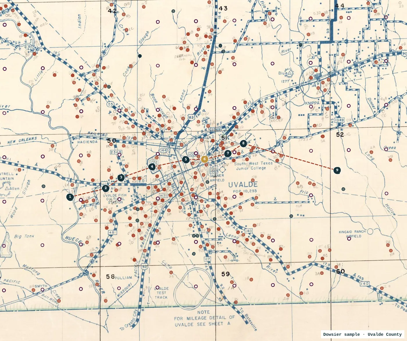
Each well where the state plotted it
Every dot is a scanned report, placed on the 1958 highway map at the pencil mark the state made for it, or at the lat/long written on the form. Open circles sit at the center of the map grid cell named on the form, so their position is only good to about 1.5 miles.
The driller’s log, as written
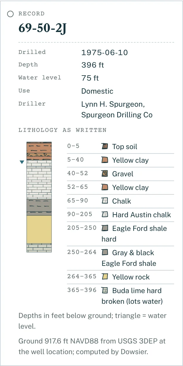
- Exactly as written. Depths, materials and water notes are copied from the report. Nothing is corrected or reinterpreted, and every record points back to its scanned page.
- Searchable. Look up a well number, a driller or a date instead of paging through PDFs.
- Checked against TWDB. Each record shows the nearest well in the TWDB Groundwater Database, so you can see which logs aren’t in the state database at all.
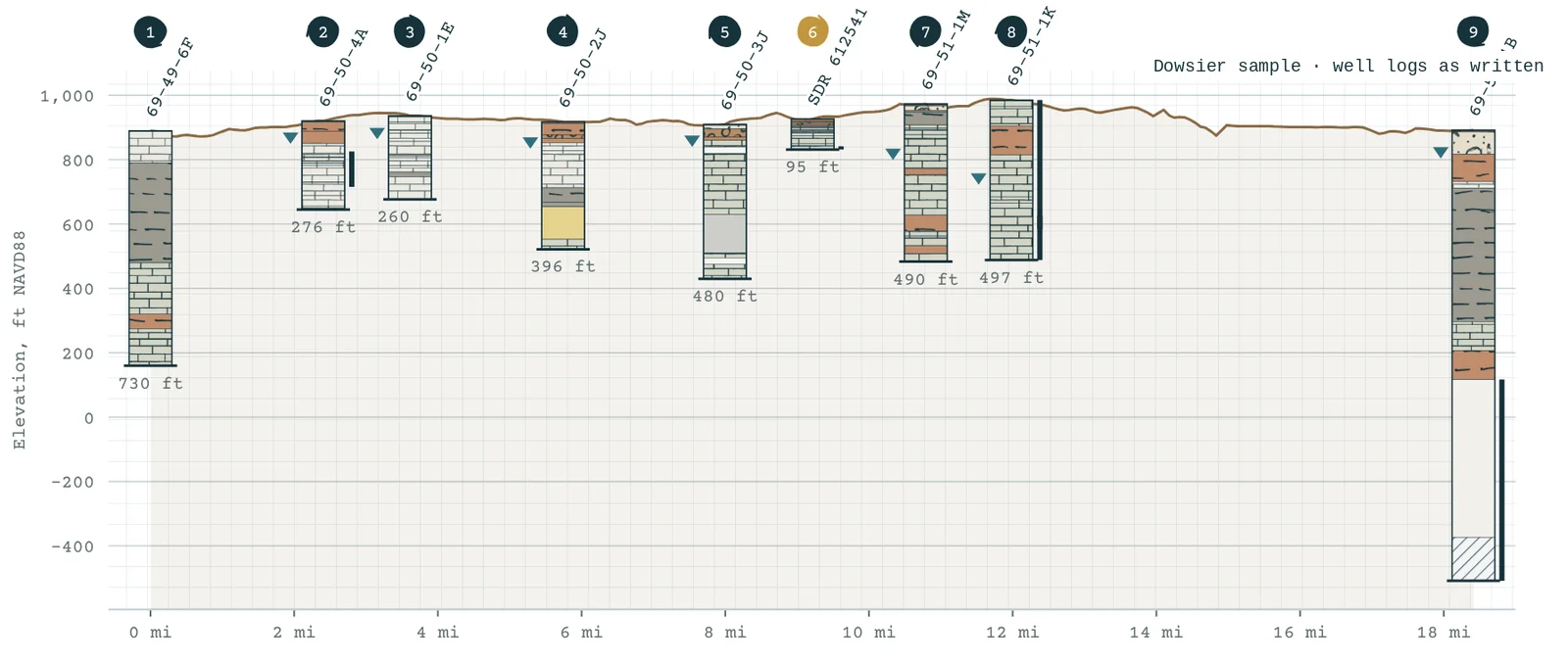
Side by side
Pick wells along a line and see their logs hung from ground elevation (USGS 3DEP). Wells are shown side by side as written; no layers are drawn between them.
Want the records around your site?
Give us a site and a search radius. The scanned well records inside it come with your dossier, alongside the state databases, water levels, geology and district rules.
Scanned-record coverage today: Kendall, Uvalde, Parker and Burnet counties. More counties to come.